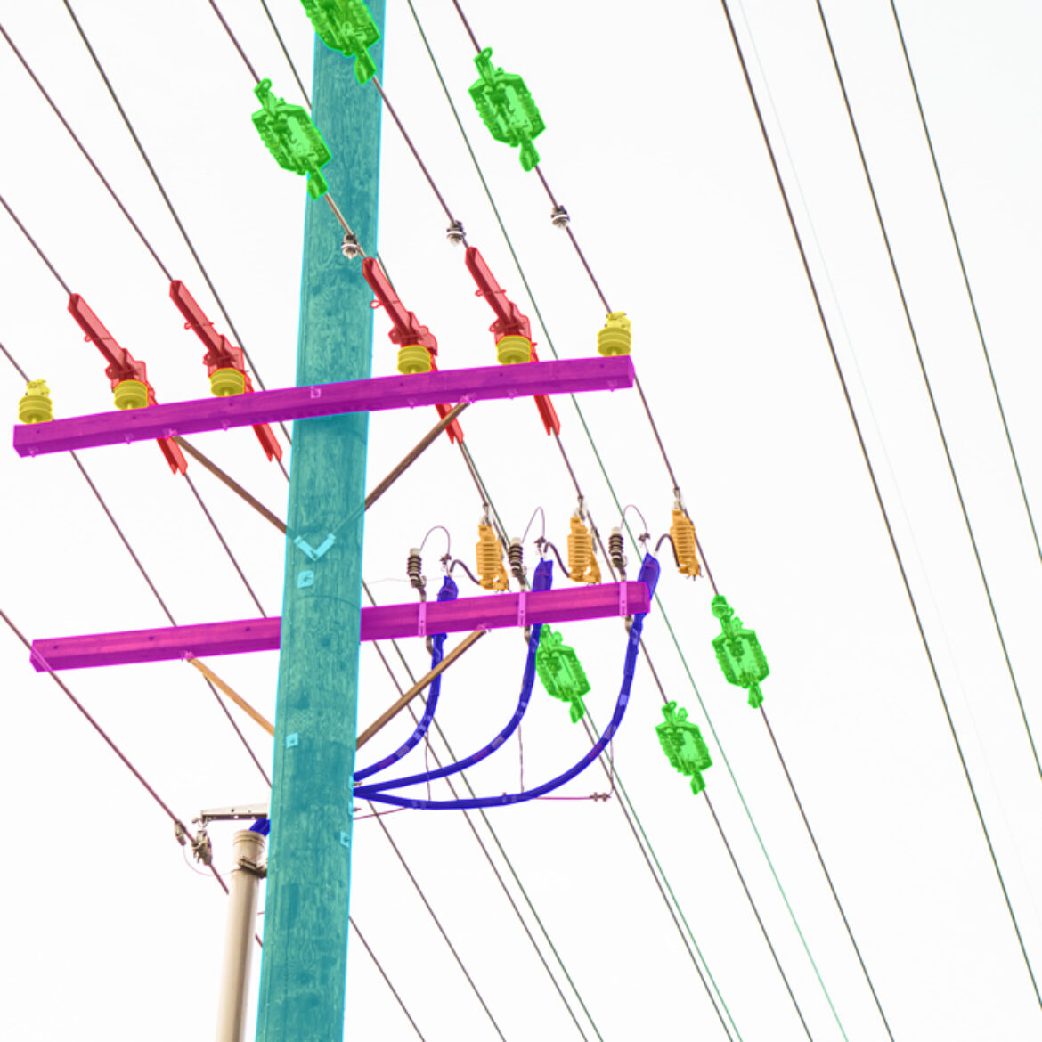
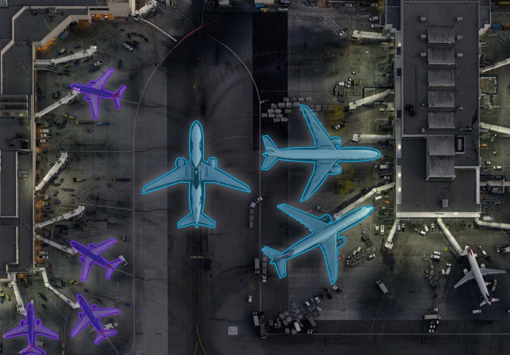
 Polygons accurately outline specific regions of interest while excluding background noise that could reduce your model’s performance. Though not as detailed as semantic segmentation, polygons are much faster to draw—making them ideal for high-volume, accurate training datasets.
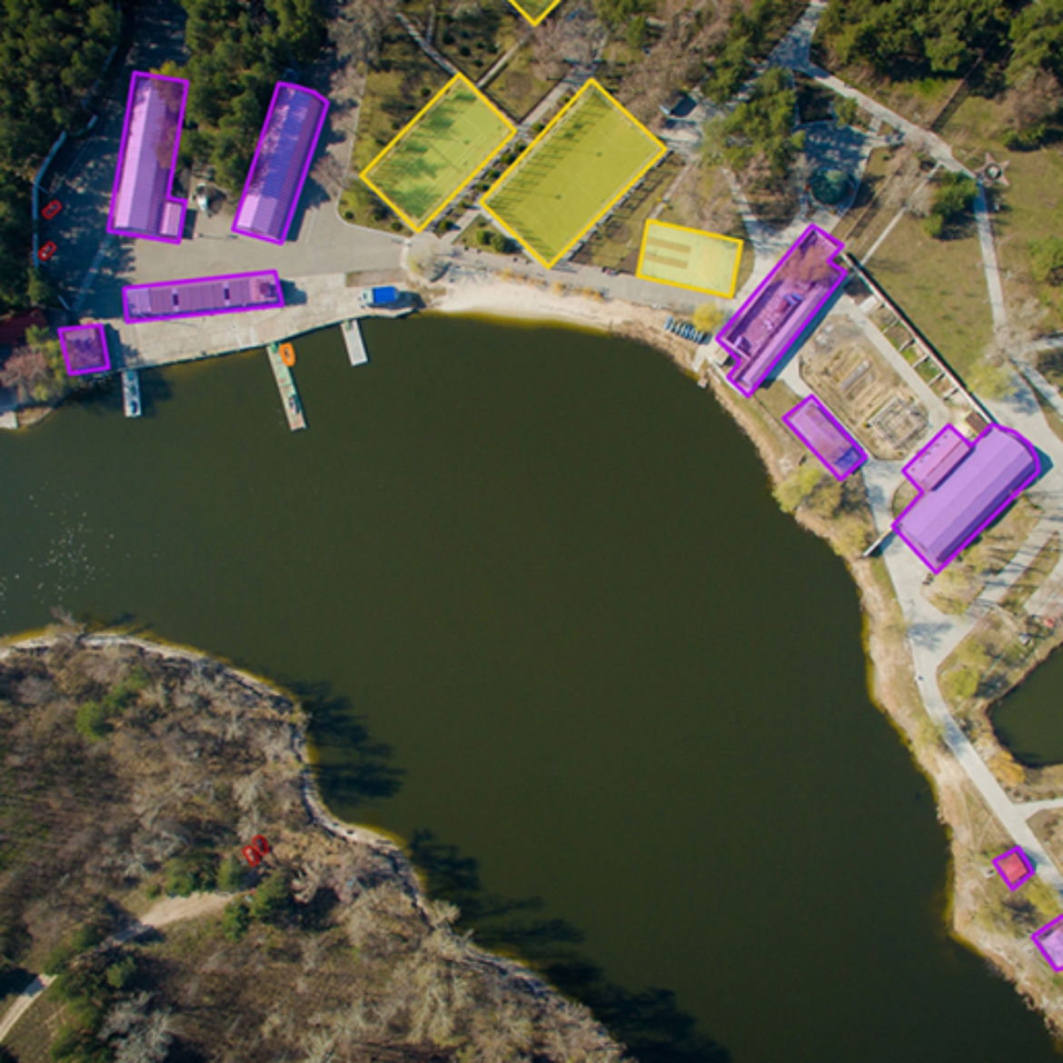
 Bounding boxes are among the most common segmentation tools. They define object shape by X and Y coordinates and are quick to implement. While fast, they may include surrounding elements, which can reduce the precision of your detection model.
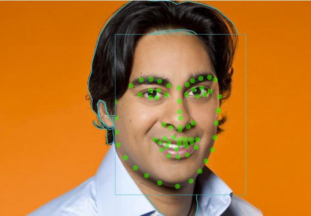 This technique uses keypoints to identify and count small objects—perfect for datasets with many small, scattered elements. Landmark annotation is highly efficient for tasks such as object tracking or movement detection in dense environments.


« Ingedata does a really good job. It’s great how we set a labeling process to segment and label our satellite images. They built a specialized team of annotators for photo interpretation and my data labeling pipeline is now more efficient and qualitative. It’s almost like having my own team of annotators. I just choose the image dataset and add it to Ingedata’s annotation backlog. Thanks, guys! »
Renaud Allioux CTO @PreligensIngedata has the largest photo interpretation team in Africa, with over 100 photo interpreters working on Earth observation projects.
We even work for the French and the US Departments of Defense, which demonstrates our ability to fit into projects with high confidentiality requirements.
By offering a high-precision geospatial imagery service, our team of experts provides accurate information to our clients, which gives them a recognized competitive advantage.